
Solar Panel Analysis
Project Information
I conducted a solar panel suitability analysis for Dalhousie University in Halifax, Nova Scotia using ArcGIS Pro. I began by downloading and organizing various datasets, including building footprints, parks, streets, water features, and LiDAR data. After projecting all data to UTM Zone 20, I created a custom study area for the Dalhousie campus and clipped all layers accordingly. Using a provided CSV of Dalhousie buildings, I joined and filtered the data to isolate 167 relevant buildings, then converted LiDAR data to a raster and extracted elevation values for just those buildings.
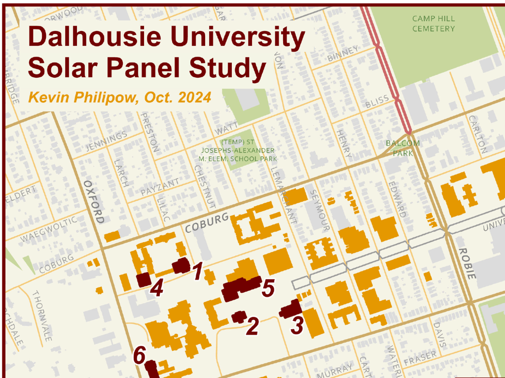
I used the Area Solar Radiation tool to calculate potential solar energy on December 21 and identified six buildings with the best exposure. These were exported into a new feature class and labeled for solar panel suitability. Next, I designed a clear, letter-sized map layout with consistent symbology for context layers and standout symbols for the analysis results. I created labels, converted them to annotations for better placement, and included an inset map to show solar radiation patterns.