
Bathymetric Map
Project Information
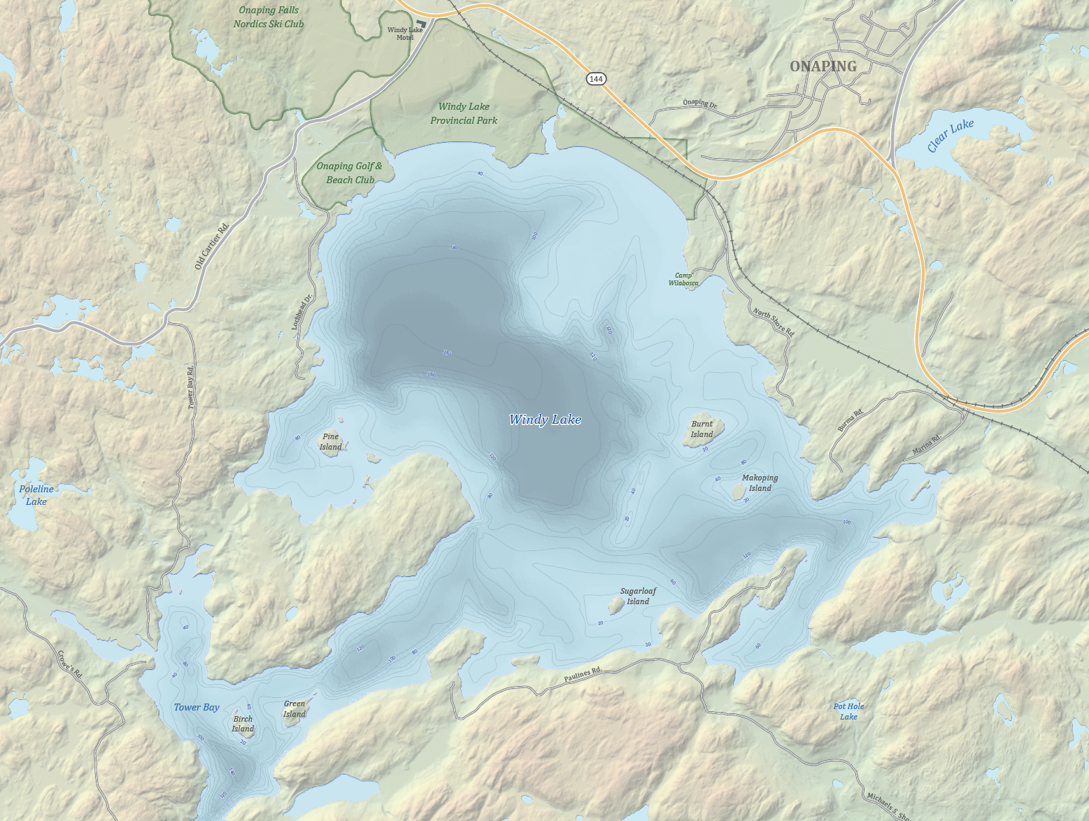
The main purpose of this project was to experiment with bathymetry and some artistic water effects. The map depicts Windy Lake, approximately 45 kilometres northwest of downtown Sudbury, Ontario. The workflow in ArcGIS Pro for the contour lines was the same as creating contour lines for land elevation, but a bathymetry colour scheme was used to symbolize various depths of water. Focal statistics were applied to blur the interval breaks and a ripple effect was applied in Adobe Photoshop to simulate waves. To help the water features stand out, a beveled edge effect was applied to give the slight impression of a shadow. Land features were created from a digital elevation model, which was used to create hill shades and shaded relief in ArcGIS Pro. These layers were then brought into Adobe Photoshop to build a composite image and add desired effects. The remaining features and finishing touches were created in Adobe Illustrator.