
Le Tour du Mont Blanc
Project Information
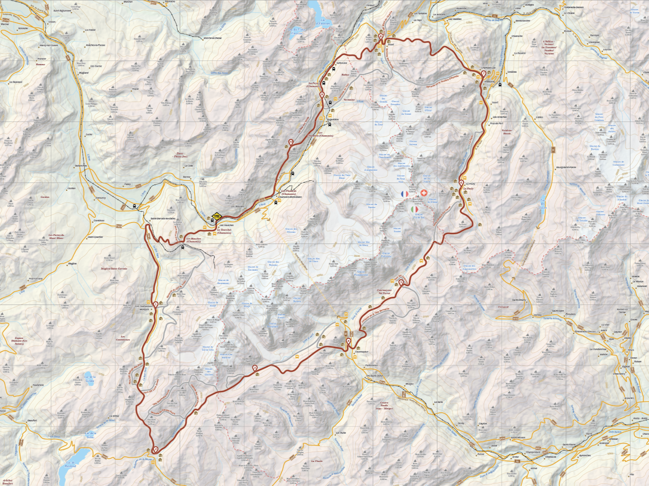
For my applied thematic project, I created a large (36" x 24") foldable topographic trail map of le tour du Mont Blanc. I chose this topic for my project because it allowed me to apply most of the skills I've developed over the past year in my coursework. The map is designed to be a comprehensive guide for hikers. It contains detailed information about the terrain, as well as descriptions of each stage of the hike and the various points of interest along the trail. It also offers practical advice on what to expect and how to prepare for the journey. In addition, the map functions as a tourism brochure, featuring numerous photos that showcase the natural beauty of the region. A considerable amount of research and data preparation went into the project, and great care was taken in creating a final product that's beneficial to the end user and effectively showcases the study area.
The data was processed in ArcGIS Pro. Once the map was properly plotted, generalized, and annotated, I exported my hill shade to Adobe Photoshop to apply the desired raster styling effects, then brought the map into Adobe Illustrator for vector styling. Some of the elements for the backside of the map were created in Microsoft Excel, then the text and photos were added to Adobe InDesign, where I finalized the layout, ensuring proper spacing for the map folds. I also translated this project, so there is a French version available as well.