
Projected Coordinate Systems
Project Information
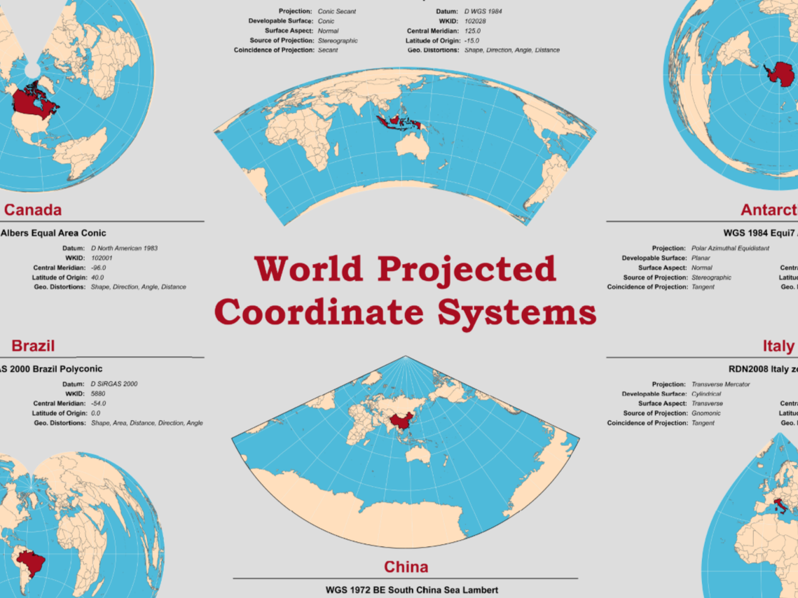
For this projection poster, I researched and applied appropriate Projected Coordinate Systems (PCS) to maps of six different countries using ArcGIS Pro. The goal was to better understand how map projections vary by region and to communicate that visually through a well-designed A1-sized poster. For each country, I identified and applied a PCS that suited its geographic location, then wrote a summary highlighting important features of the PCS such as its developable surface, central meridian, latitude of origin, surface aspect, and the types of distortion it created. Finally, I styled each map so the selected country stood out and assembled the maps into a cohesive poster layout.